

Oregon
from $55.00
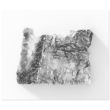
Digitally-rendered 3-dimensional elevation of Oregon. 2D print Lustre Prints: Archival photo inkjet print on lustre (slight sheen) paper. Matte Gi...
View full details
Digitally-rendered 3-dimensional elevation of Oregon. 2D print Lustre Prints: Archival photo inkjet print on lustre (slight sheen) paper. Matte Gi...
View full details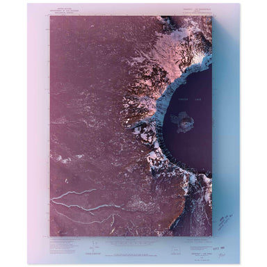
1975 United State Geological Survey topographic map of Crater Lake, Oregon combined with a digitally-rendered 3-dimensional elevation. 2D print Lu...
View full details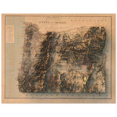
1879 Department of the Interior, General Land Office map of Oregon combined with a digitally-rendered 3-dimensional elevation. 2D print Lustre Pri...
View full details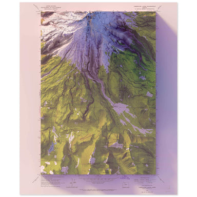
1962 United States Geological Survey topographic map of Mt. Hood, Oregon combined with a digitally-rendered 3-dimensional elevation. 2D print Lust...
View full details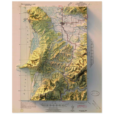
1942 United States Geological Survey topographic map of Tillamook, Oregon combined with a digitally-rendered 3-dimensional elevation. 2D print Lus...
View full details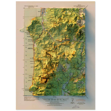
1920 United States Geological Survey topographic map of Cape Falcon, Oregon combined with a digitally-rendered 3-dimensional elevation. 2D print L...
View full details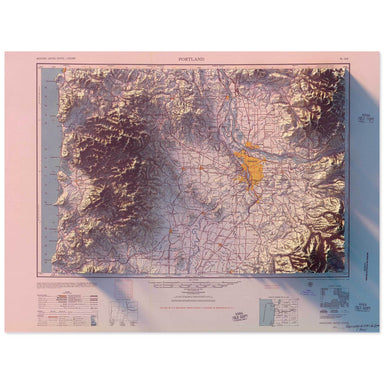
1957 Army Map Service topographic map of Portland, Oregon* combined with a digitally-rendered 3-dimensional elevation. 2D print Lustre Prints: Arc...
View full details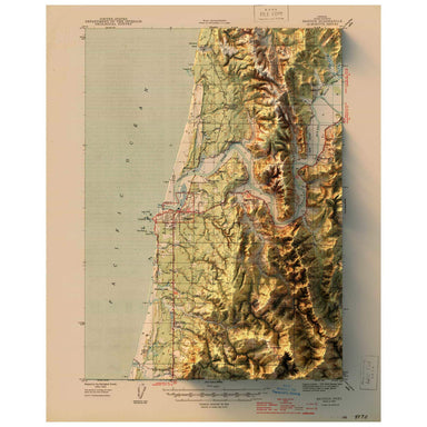
1944 United States Geological Survey topographic map of Bandon, Oregon combined with a digitally-rendered 3-dimensional elevation. 2D print Lustre...
View full details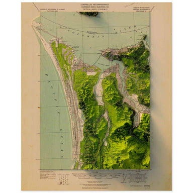
1919 United States Geological Survey topographic map of Astoria, Oregon combined with a digitally-rendered 3-dimensional elevation. 2D print Lustr...
View full details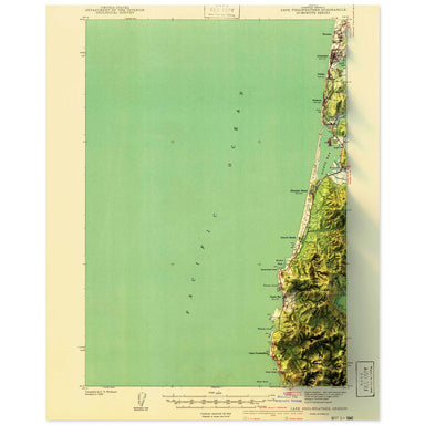
1941 United States Geological Survey topographic map of Cape Foulweather, Oregon combined with a digitally-rendered 3-dimensional elevation. 2D pr...
View full details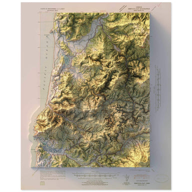
1941 United States Geological Survey topographic map of Nestucca Bay, Oregon combined with a digitally-rendered 3-dimensional elevation. 2D print ...
View full details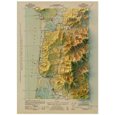
1943 United States Geological Survey topographic map of Nehalem, Oregon combined with a digitally-rendered 3-dimensional elevation. 2D print Lustr...
View full details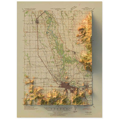
1940 United States Geological Survey topographic map of Eugene, Oregon combined with a digitally-rendered 3-dimensional elevation. 2D print Lustre...
View full details

A contemporary portrait of Oregon, drawn from tree coverage data and rendered with a minimalist approach. Each poster balances high-resolution cart...
View full details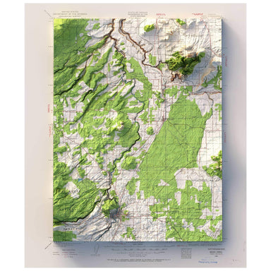
1926 United States Geological Survey map of Bend, Oregon combined with a digitally-rendered 3-dimensional elevation. 2D print Lustre Prints: Archi...
View full details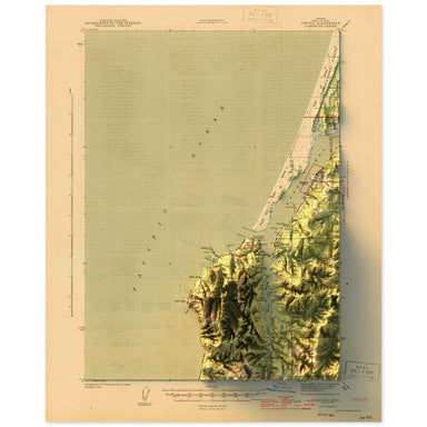
1944 United States Geological Survey topographic map of Empire, Oregon combined with a digitally-rendered 3-dimensional elevation. 2D print Lustre...
View full details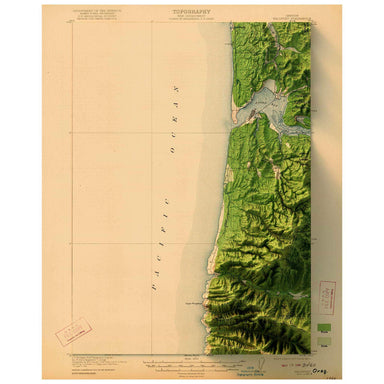
1922 United States Geological Survey topographic map of Waldport, Oregon combined with a digitally-rendered 3-dimensional elevation. 2D print Lust...
View full details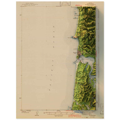
1942 United States Geological Survey topographic map of Yaquina, Oregon combined with a digitally-rendered 3-dimensional elevation. 2D print Lustr...
View full details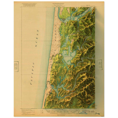
1920 United States Geological Survey topographic map of Siltcoos Lake, Oregon combined with a digitally-rendered 3-dimensional elevation. 2D print...
View full details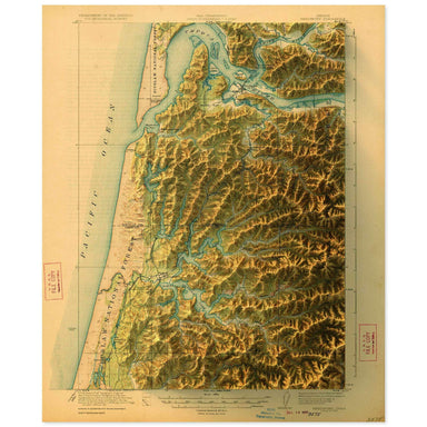
1923 United States Geological Survey topographic map of Reedsport, Oregon combined with a digitally-rendered 3-dimensional elevation. 2D print Lus...
View full details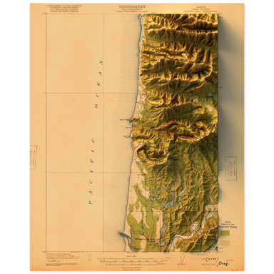
1920 United States Geological Survey topographic map of Heceta Head, Oregon combined with a digitally-rendered 3-dimensional elevation. 2D print L...
View full details