

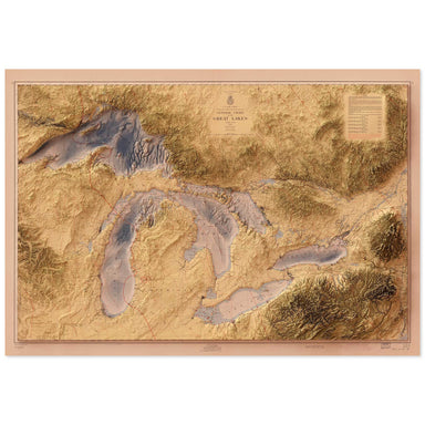
The Great Lakes
from $55.00
1955 United States Army Corps of Engineers map of the Great Lakes combined with a digitally-rendered 3-dimensional elevation. 2D print Lustre Prin...
View full details
1955 United States Army Corps of Engineers map of the Great Lakes combined with a digitally-rendered 3-dimensional elevation. 2D print Lustre Prin...
View full details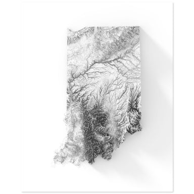
Digitally-rendered 3-dimensional elevation of Indiana. 2D print Lustre Prints: Archival photo inkjet print on lustre (slight sheen) paper. Matte G...
View full details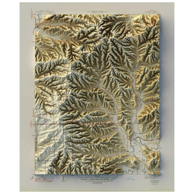
1947 United States Geological Survey map of Unionville, Indiana combined with a digitally-rendered 3-dimensional elevation. 2D print Lustre Prints...
View full details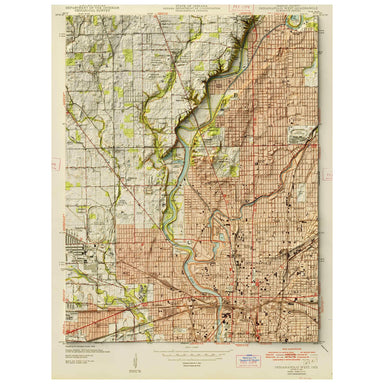
1948 United States Geological Survey map of Indianapolis, Indiana combined with a digitally-rendered 3-dimensional elevation. 2D print Lustre Prin...
View full details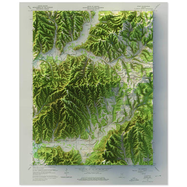
1967 United States Geological Survey map of Story, Indiana combined with a digitally-rendered 3-dimensional elevation. 2D print Lustre Prints: Arc...
View full details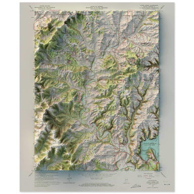
1965 United States Geological Survey map of Clear Creek, Indiana combined with a digitally-rendered 3-dimensional elevation. 2D print Lustre Print...
View full details

A contemporary portrait of Indiana, drawn from agricultural coverage data and rendered with a minimalist approach. Each poster balances high-resolu...
View full details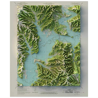
1966 United States Geological Survey map of Allens Creek, Indiana combined with a digitally-rendered 3-dimensional elevation. 2D print Lustre Prin...
View full details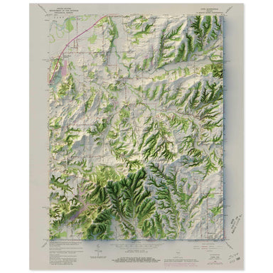
1965 United States Geological Survey map of Cope, Indiana combined with a digitally-rendered 3-dimensional elevation. 2D print Lustre Prints: Arch...
View full details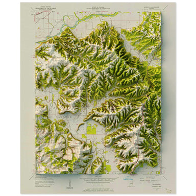
1957 United States Geological Survey map of Modesto, Indiana combined with a digitally-rendered 3-dimensional elevation. 2D print Lustre Prints: A...
View full details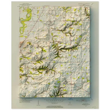
1952 United States Geological Survey map of Bargersville, Indiana combined with a digitally-rendered 3-dimensional elevation. 2D print Lustre Prin...
View full details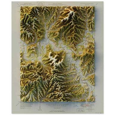
1950 United States Geological Survey map of Elkinsville, Indiana combined with a digitally-rendered 3-dimensional elevation. 2D print Lustre Print...
View full details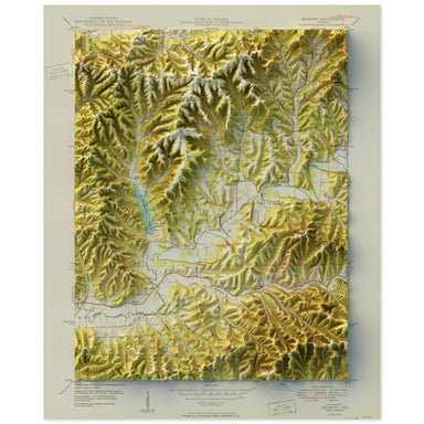
1950 United States Geological Survey map of Belmont, Indiana combined with a digitally-rendered 3-dimensional elevation. 2D print Lustre Prints: A...
View full details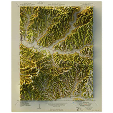
1949 United States Geological Survey map of Nashville, Indiana combined with a digitally-rendered 3-dimensional elevation. 2D print Lustre Prints:...
View full details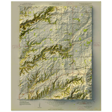
1948 United States Geological Survey map of Trafalgar, Indiana combined with a digitally-rendered 3-dimensional elevation. 2D print Lustre Prints:...
View full details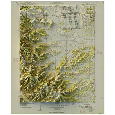
1948 United States Geological Survey map of Ninevah, Indiana combined with a digitally-rendered 3-dimensional elevation. 2D print Lustre Prints: A...
View full details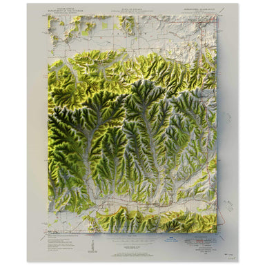
1948 United States Geological Survey map of Morgantown, Indiana combined with a digitally-rendered 3-dimensional elevation. 2D print Lustre Prints...
View full details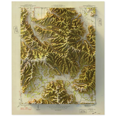
1948 United States Geological Survey map of Hindustan, Indiana combined with a digitally-rendered 3-dimensional elevation. 2D print Lustre Prints:...
View full details