

The Great Lakes
from $55.00
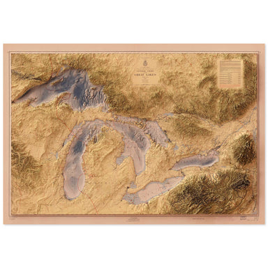
1955 United States Army Corps of Engineers map of the Great Lakes combined with a digitally-rendered 3-dimensional elevation. 2D print Lustre Prin...
View full details
1955 United States Army Corps of Engineers map of the Great Lakes combined with a digitally-rendered 3-dimensional elevation. 2D print Lustre Prin...
View full details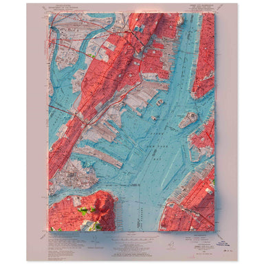
1955 United States Geological Survey topographic map of the New York Harbor combined with a digitally-rendered 3-dimensional bathymetry and elevati...
View full details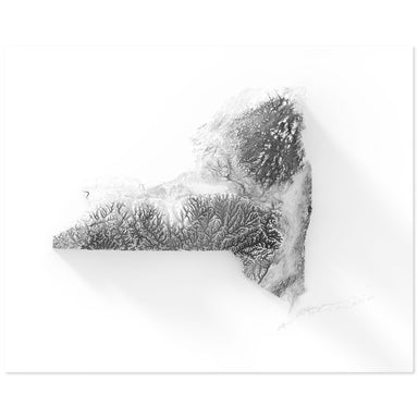
Digitally-rendered 3-dimensional elevation of New York. 2D print Lustre Prints: Archival photo inkjet print on lustre (slight sheen) paper. Matte ...
View full details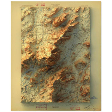
1896 United States Geological Survey map of Lake Placid, New York combined with a digitally-rendered 3-dimensional elevation. 2D print Lustre Prin...
View full details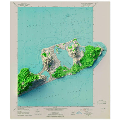
1956 United States Geological Survey topographic map of Montauk, New York combined with a digitally-rendered 3-dimensional elevation. 2D print Lus...
View full details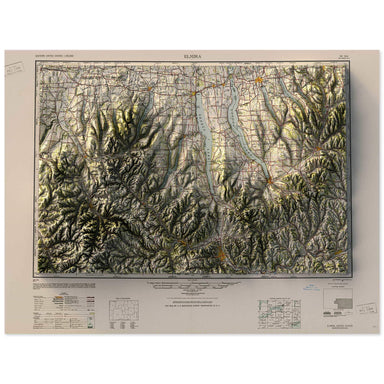
1950 Army Map Service map of the Finger Lakes, New York combined with a digitally-rendered 3-dimensional elevation. 2D print Lustre Prints: Archiv...
View full details
1956 USGS Map of Beacon, New York combined with a digitally-rendered 3-dimensional elevation. 2D print Lustre Prints: Archival photo inkjet print ...
View full details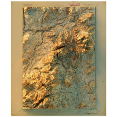
1895 United States Geological Survey topographic map of Ausable, New York combined with a digitally-rendered 3-dimensional elevation. 2D print Lus...
View full details
1957 USGS Map of Poughkeepsie, New York combined with a digitally-rendered 3-dimensional elevation. 2D print Lustre Prints: Archival photo inkjet ...
View full details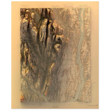
1893 United States Geological Survey topographic map of the Hudson, New York region combined with a digitally-rendered 3-dimensional elevation. 2D...
View full details
1963 USGS Map of Kingston, New York combined with a digitally-rendered 3-dimensional elevation. 2D print Lustre Prints: Archival photo inkjet prin...
View full details

A contemporary portrait of New York, drawn from agricultural coverage data and rendered with a minimalist approach. Each poster balances high-resol...
View full details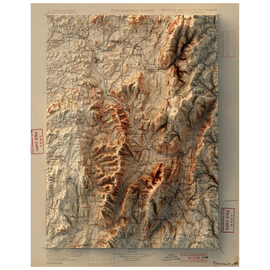
1900 United States Geological Survey map of Taconic, New York combined with a digitally-rendered 3-dimensional elevation. 2D print Lustre Prints: ...
View full details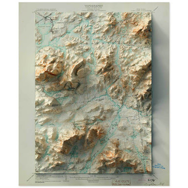
1904 United States Geological Survey map of Long Lake, New York combined with a digitally-rendered 3-dimensional elevation. 2D print Lustre Prints...
View full details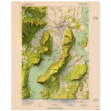
1952 United States Geological Survey topographic map of Sodus, New York combined with a digitally-rendered 3-dimensional elevation. 2D print Lustr...
View full details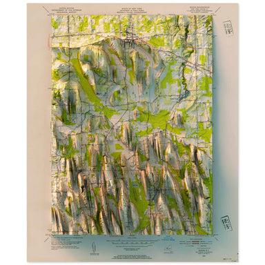
1952 United States Geological Survey topographic map of Sodus, New York combined with a digitally-rendered 3-dimensional elevation. 2D print Lustr...
View full details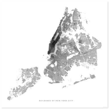
Every building in New York City digitally rendered. 2D print Lustre Prints: Archival photo inkjet print on lustre (slight sheen) paper. Matte Gicl...
View full details
1941 USGS Map of West Point, New York combined with a digitally-rendered 3-dimensional elevation. 2D print Lustre Prints: Archival photo inkjet pr...
View full details
1943 USGS Map of Oneonta, New York combined with a digitally-rendered 3-dimensional elevation. 2D print Lustre Prints: Archival photo inkjet print...
View full details
1940 USGS Map of Nyack, New York combined with a digitally-rendered 3-dimensional elevation. 2D print Lustre Prints: Archival photo inkjet print o...
View full details
1963 USGS Map of Hyde Park, New York combined with a digitally-rendered 3-dimensional elevation. 2D print Lustre Prints: Archival photo inkjet pri...
View full details
1957 USGS Map of Peekskill, New York combined with a digitally-rendered 3-dimensional elevation. 2D print Lustre Prints: Archival photo inkjet pri...
View full details

A contemporary portrait of New York, drawn from tree coverage data and rendered with a minimalist approach. Each poster balances high-resolution ca...
View full details

A contemporary portrait of New York, drawn from land use data and rendered with a minimalist approach. Each poster balances high-resolution cartogr...
View full details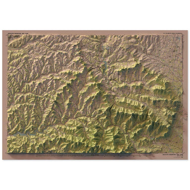
1986 United States Geological Survey map of Pepacton, New York combined with a digitally-rendered 3-dimensional elevation. 2D print Lustre Prints:...
View full details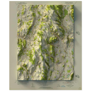
1955 United States Geological Survey map of Millerton, New York combined with a digitally-rendered 3-dimensional elevation. 2D print Lustre Prints...
View full details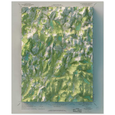
1967 United States Geological Survey map of Lake Huntington, New York combined with a digitally-rendered 3-dimensional elevation. 2D print Lustre ...
View full details