

Colorado
from $55.00
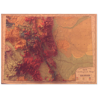
1880 Rand, McNally & Co. map of the geology of Colorado combined with a digitally-rendered 3-dimensional elevation. 2D print Lustre Prints: Ar...
View full details
1880 Rand, McNally & Co. map of the geology of Colorado combined with a digitally-rendered 3-dimensional elevation. 2D print Lustre Prints: Ar...
View full details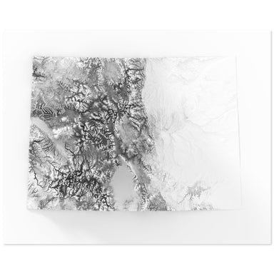
Digitally-rendered 3-dimensional elevation of Colorado. 2D print Lustre Prints: Archival photo inkjet print on lustre (slight sheen) paper. Matte ...
View full details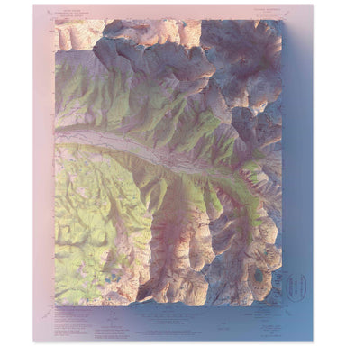
1955 United States Geological Survey geological map of Telluride, Colorado combined with a digitally-rendered 3-dimensional elevation. 2D print Lu...
View full details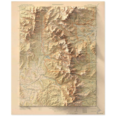
1915 United States Geological Survey topographic map of the Rocky Mountain National Park region combined with a digitally-rendered 3-dimensional el...
View full details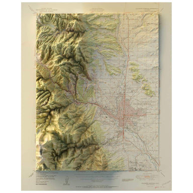
1951 United States Geological Survey map of Colorado Springs, Colorado combined with a digitally-rendered 3-dimensional elevation. 2D print Lustre...
View full details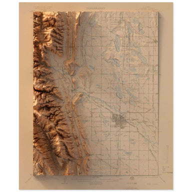
1906 United States Geological Survey topographic map of Ft. Collins, Colorado combined with a digitally-rendered 3-dimensional elevation. 2D print...
View full details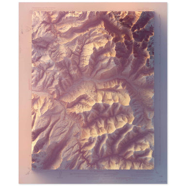
1934 United States Geological Survey geological map of Vail, Colorado combined with a digitally-rendered 3-dimensional elevation. 2D print Lustre ...
View full details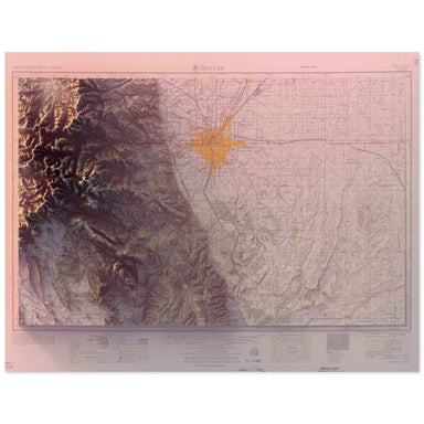
1957 United States Geological Survey geological map of Denver, Colorado combined with a digitally-rendered 3-dimensional elevation. 2D print Lustr...
View full details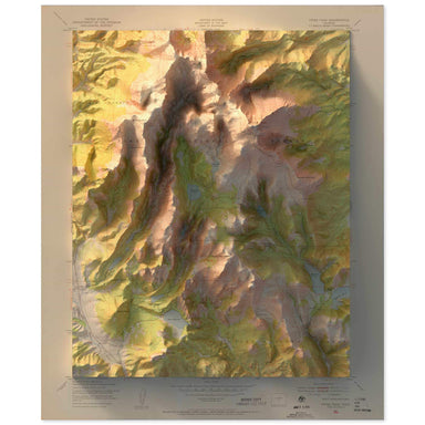
1951 United States Geological Survey topographic map of Pikes Peak, Colorado combined with a digitally-rendered 3-dimensional elevation. 2D print ...
View full details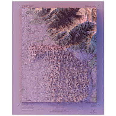
1967 United States Geological Survey map of Great Sand Dunes National Park combined with a digitally-rendered 3-dimensional elevation. 2D print Lu...
View full details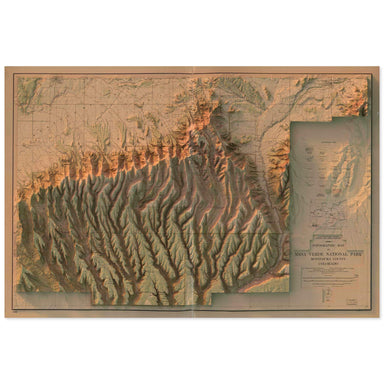
1915 United States Geological Survey topographic map of Mesa Verde National Park combined with a digitally-rendered 3-dimensional elevation. 2D pr...
View full details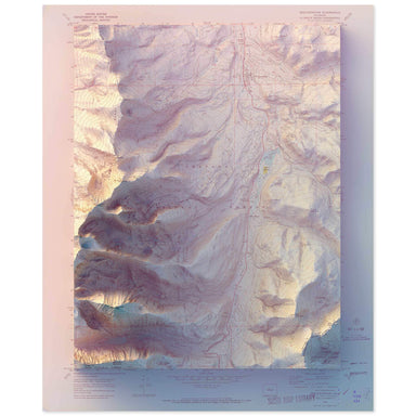
1970 United States Geological Survey geological map of Breckenridge, Colorado combined with a digitally-rendered 3-dimensional elevation. 2D print...
View full details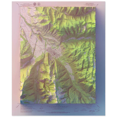
1960 United States Geological Survey geological map of Aspen, Colorado combined with a digitally-rendered 3-dimensional elevation. 2D print Lustre...
View full details

A contemporary portrait of Colorado, drawn from tree coverage data and rendered with a minimalist approach. Each poster balances high-resolution ca...
View full details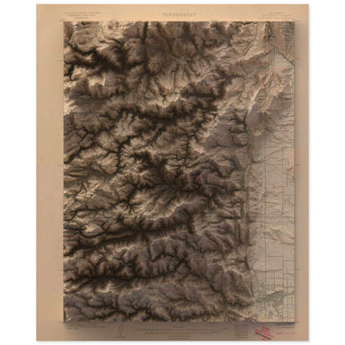
1904 United States Geological Survey geological map of Boulder, Colorado combined with a digitally-rendered 3-dimensional elevation. 2D print Lust...
View full details