

The Great Lakes
from $55.00
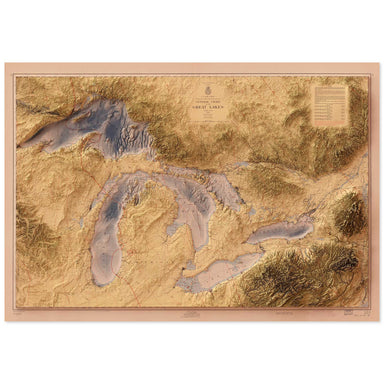
1955 United States Army Corps of Engineers map of the Great Lakes combined with a digitally-rendered 3-dimensional elevation. 2D print Lustre Prin...
View full details
1955 United States Army Corps of Engineers map of the Great Lakes combined with a digitally-rendered 3-dimensional elevation. 2D print Lustre Prin...
View full details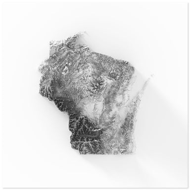
Digitally-rendered 3-dimensional elevation of Wisconsin. 2D print Lustre Prints: Archival photo inkjet print on lustre (slight sheen) paper. Matte...
View full details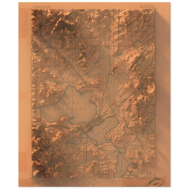
1890 United States Geological Survey topographic map of the Madison, Wisconsin combined with a digitally-rendered 3-dimensional elevation. 2D prin...
View full details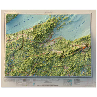
1958 Army Map Service map of Ashland, Wisconsin combined with a digitally-rendered 3-dimensional elevation. 2D print Lustre Prints: Archival photo...
View full details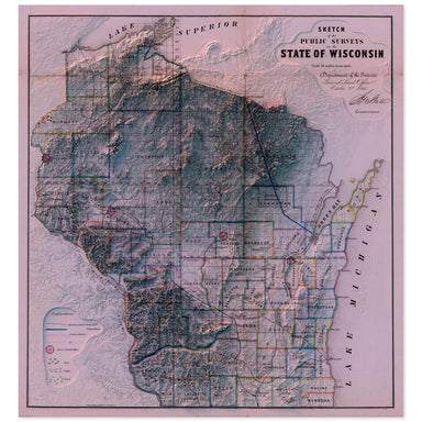
1866 “Sketch of the Public Surveys in the State of Wisconsin” from the Department of the Interior General Land Office combined with a digitally-ren...
View full details

A contemporary portrait of Wisconsin, drawn from hydrologic data and rendered with a minimalist approach. Each poster balances high-resolution cart...
View full details

A contemporary portrait of Wisconsin, drawn from tree coverage data and rendered with a minimalist approach. Each poster balances high-resolution c...
View full details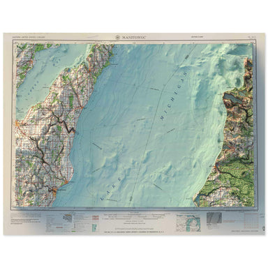
1958 Army Map Service map of Manitowoc, Wisconsin combined with a digitally-rendered 3-dimensional elevation. 2D print Lustre Prints: Archival pho...
View full details