

Horseshoe Lake, Arkansas
from $55.00
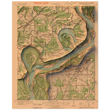
1931 United States Geological Survey topographic map of Horseshoe Lake, Arkansas combined with a digitally-rendered 3-dimensional elevation. 2D pr...
View full details
1931 United States Geological Survey topographic map of Horseshoe Lake, Arkansas combined with a digitally-rendered 3-dimensional elevation. 2D pr...
View full details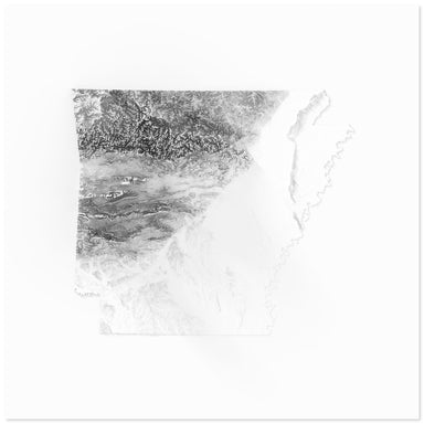
Digitally-rendered 3-dimensional elevation of Arkansas. 2D print Lustre Prints: Archival photo inkjet print on lustre (slight sheen) paper. Matte ...
View full details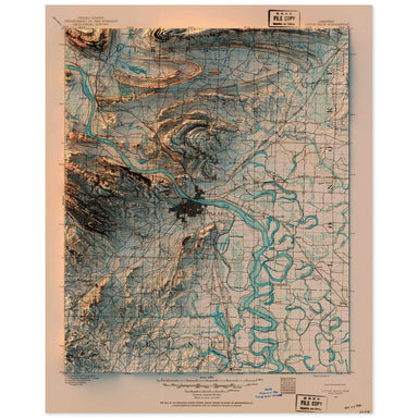
1891 United States Geological Survey topographic map of Little Rock, Arkansas combined with a digitally-rendered 3-dimensional elevation. 2D print...
View full details

A contemporary portrait of Arkansas, drawn from tree coverage data and rendered with a minimalist approach. Each poster balances high-resolution ca...
View full details

A contemporary portrait of Arkansas, drawn from agricultural coverage data and rendered with a minimalist approach. Each poster balances high-resol...
View full details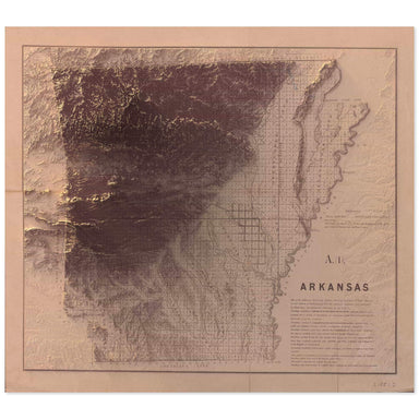
1851 map of Arkansas combined with a digitally-rendered 3-dimensional elevation. 2D print Lustre Prints: Archival photo inkjet print on lustre (sl...
View full details