

The Great Lakes
from $55.00
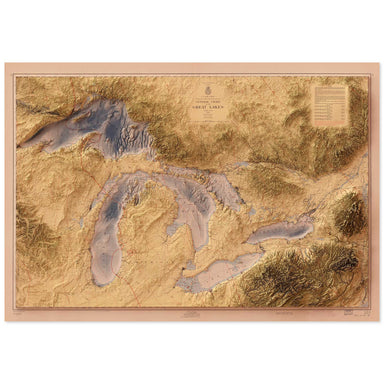
1955 United States Army Corps of Engineers map of the Great Lakes combined with a digitally-rendered 3-dimensional elevation. 2D print Lustre Prin...
View full details
1955 United States Army Corps of Engineers map of the Great Lakes combined with a digitally-rendered 3-dimensional elevation. 2D print Lustre Prin...
View full details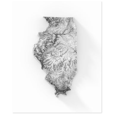
Digitally-rendered 3-dimensional elevation of Illinois. 2D print Lustre Prints: Archival photo inkjet print on lustre (slight sheen) paper. Matte ...
View full details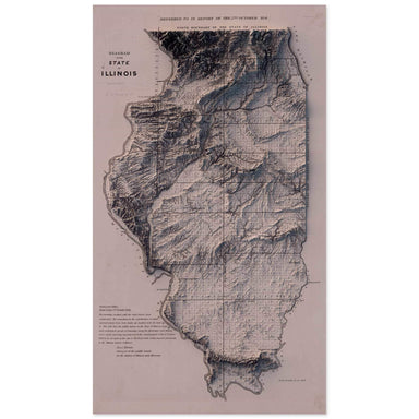
1841 "Diagram of the State of Illinois" combined with a digitally-rendered 3-dimensional elevation. 2D print Lustre Prints: Archival photo inkjet ...
View full details

A contemporary portrait of Illinois, drawn from agricultural coverage data and rendered with a minimalist approach. Each poster balances high-resol...
View full details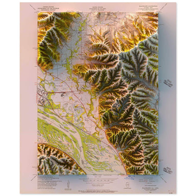
1953 United States Geological Survey topographic map of Blackhawk, Illinois combined with a digitally-rendered 3-dimensional elevation. 2D print L...
View full details