

Cape Foulweather, Oregon
from $55.00
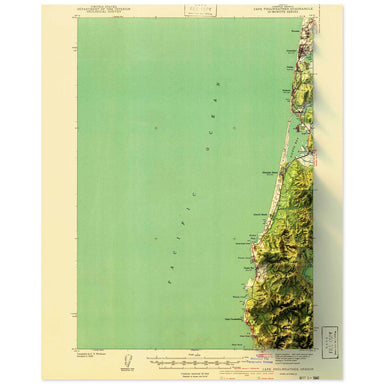
1941 United States Geological Survey topographic map of Cape Foulweather, Oregon combined with a digitally-rendered 3-dimensional elevation. 2D pr...
View full details
1941 United States Geological Survey topographic map of Cape Foulweather, Oregon combined with a digitally-rendered 3-dimensional elevation. 2D pr...
View full details
1951 USGS Map of Capell Valley, Napa Valley, California combined with a digitally-rendered 3-dimensional elevation. 2D print Lustre Prints: Archiv...
View full details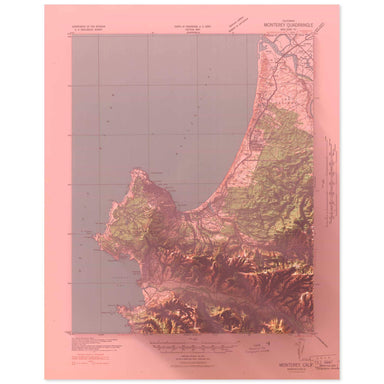
1941 United States Geological Survey topographic map of Carmel, California combined with a digitally-rendered 3-dimensional elevation. 2D print Lu...
View full details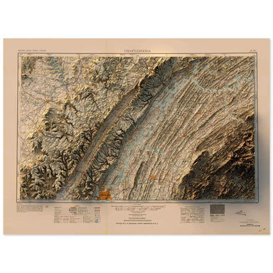
1953 United States Geological Survey map of Chattanooga, Tennessee combined with a digitally-rendered 3-dimensional elevation. 2D print Lustre Pri...
View full details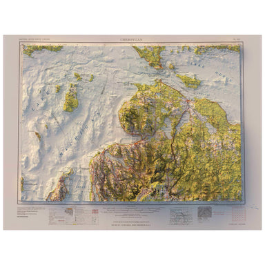
1958 Army Map Service map of Cheboygan, Michigan combined with a digitally-rendered 3-dimensional elevation. 2D print Lustre Prints: Archival phot...
View full details
1958 USGS Map of Chiles Valley, Napa Valley, California combined with a digitally-rendered 3-dimensional elevation. 2D print Lustre Prints: Archiv...
View full details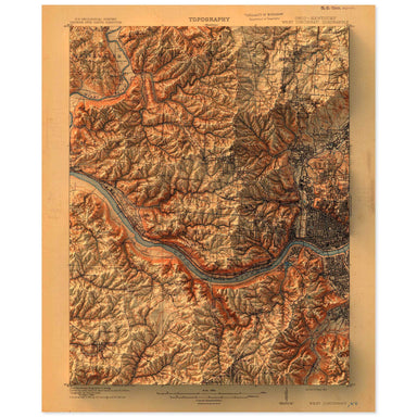
1914 United States Geological Survey topographic map of Cincinnati, Ohio combined with a digitally-rendered 3-dimensional elevation. 2D print Lust...
View full details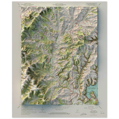
1965 United States Geological Survey map of Clear Creek, Indiana combined with a digitally-rendered 3-dimensional elevation. 2D print Lustre Print...
View full details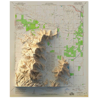
1959 United States Geological Survey topographic map of the Coachella Valley, California combined with a digitally-rendered 3-dimensional elevation...
View full details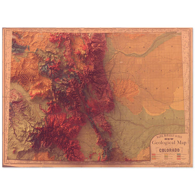
1880 Rand, McNally & Co. map of the geology of Colorado combined with a digitally-rendered 3-dimensional elevation. 2D print Lustre Prints: Ar...
View full details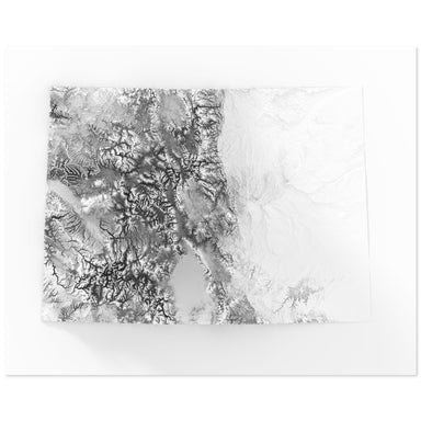
Digitally-rendered 3-dimensional elevation of Colorado. 2D print Lustre Prints: Archival photo inkjet print on lustre (slight sheen) paper. Matte ...
View full details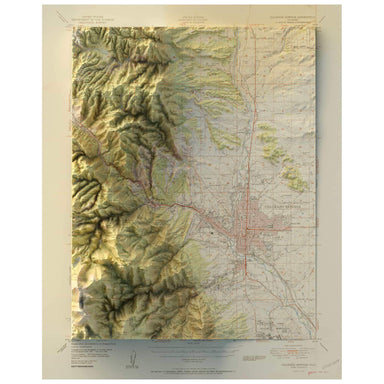
1951 United States Geological Survey map of Colorado Springs, Colorado combined with a digitally-rendered 3-dimensional elevation. 2D print Lustre...
View full details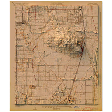
1924 United States Geological Survey topographic map of Compton, Los Angeles, California combined with a digitally-rendered 3-dimensional elevation...
View full details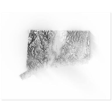
Digitally-rendered 3-dimensional elevation of Connecticut. 2D print Lustre Prints: Archival photo inkjet print on lustre (slight sheen) paper. Mat...
View full details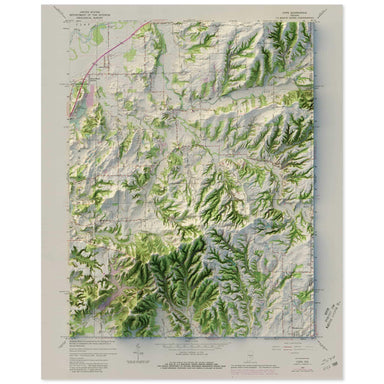
1965 United States Geological Survey map of Cope, Indiana combined with a digitally-rendered 3-dimensional elevation. 2D print Lustre Prints: Arch...
View full details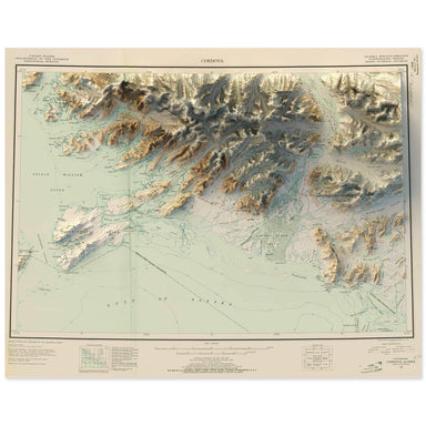
1948 United States Geological Survey map of Cordova, Alaska combined with a digitally-rendered 3-dimensional elevation. 2D print Lustre Prints: Ar...
View full details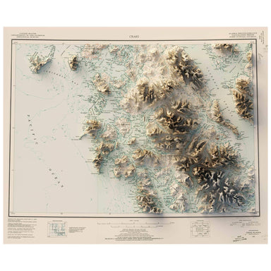
1952 United States Geological Survey map of Craig, Alaska combined with a digitally-rendered 3-dimensional elevation. 2D print Lustre Prints: Arch...
View full details
1975 United State Geological Survey topographic map of Crater Lake, Oregon combined with a digitally-rendered 3-dimensional elevation. 2D print Lu...
View full details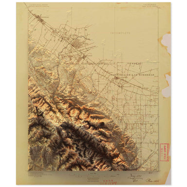
1890 United States Geological Survey topographic map of Cupertino, California combined with a digitally-rendered 3-dimensional elevation. 2D print...
View full details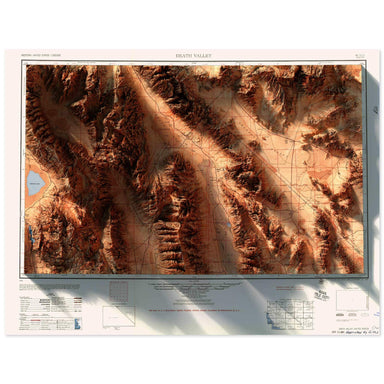
1956 Army Map Services topographic map of Death Valley, California combined with a digitally-rendered 3-dimensional elevation. 2D print Lustre Pri...
View full details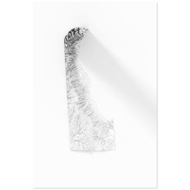
Digitally-rendered 3-dimensional elevation of Delaware. 2D print Lustre Prints: Archival photo inkjet print on lustre (slight sheen) paper. Matte ...
View full details
1962 United States Geological Survey topographic map of Demotte Park, Grand Canyon, Arizona combined with a digitally-rendered 3-dimensional elevat...
View full details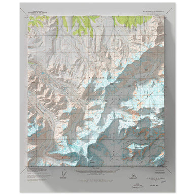
1954 United States Geological Survey map of Denali, Alaska combined with a digitally-rendered 3-dimensional elevation. 2D print Lustre Prints: Arc...
View full details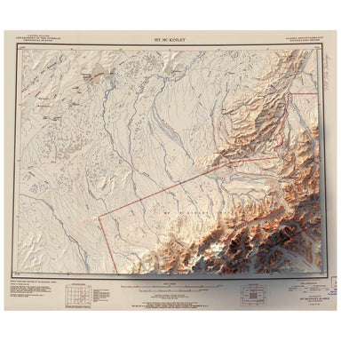
1952 United States Geological Survey map of Denali, Alaska combined with a digitally-rendered 3-dimensional elevation. 2D print Lustre Prints: Arc...
View full details