
Talkeetna, Alaska
from $55.00
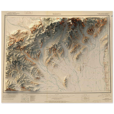
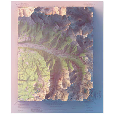
1951 United States Geological Survey map of Talkeetna, Alaska combined with a digitally-rendered 3-dimensional elevation. 2D print Lustre Prints: ...
View full details
1951 United States Geological Survey map of Talkeetna, Alaska combined with a digitally-rendered 3-dimensional elevation. 2D print Lustre Prints: ...
View full details
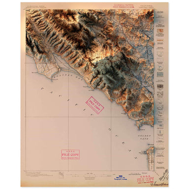
1897 United States Geological Survey topographic map of Tamalpais, California combined with a digitally-rendered 3-dimensional elevation. 2D print...
View full details
1936 United States Geological Survey topographic map of Taos, New Mexico combined with a digitally-rendered 3-dimensional elevation. 2D print Lust...
View full details
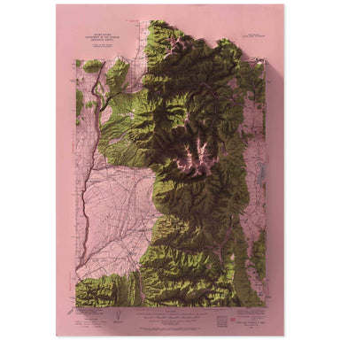
1964 United States Geological Survey map of Taos, New Mexico combined with a digitally-rendered 3-dimensional elevation. 2D print 2D print Lustre ...
View full details
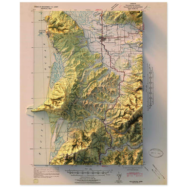
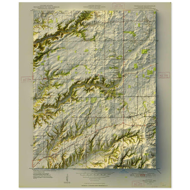
1955 United States Geological Survey geological map of Telluride, Colorado combined with a digitally-rendered 3-dimensional elevation. 2D print Lu...
View full details
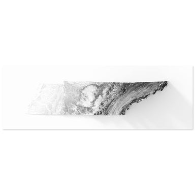
Digitally-rendered 3-dimensional elevation of Tennessee. 2D print Lustre Prints: Archival photo inkjet print on lustre (slight sheen) paper. Matte...
View full details
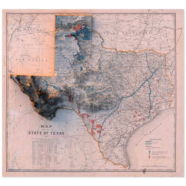
1887 “Map of the State of Texas” from the New York and Texas Land Company, Limited combined with a digitally-rendered 3-dimensional elevation. 2D ...
View full details
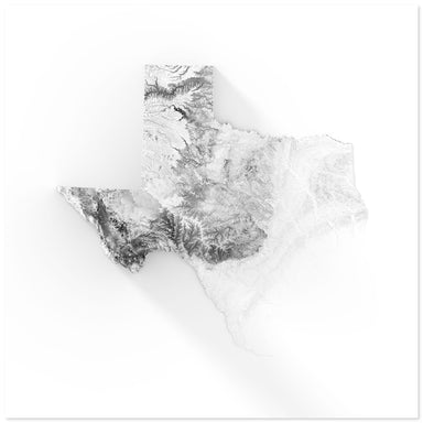
Digitally-rendered 3-dimensional elevation of Texas. 2D print Lustre Prints: Archival photo inkjet print on lustre (slight sheen) paper. Matte Gic...
View full details
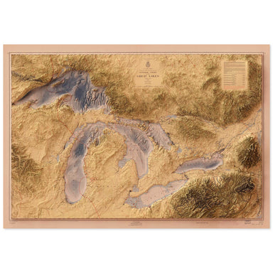
1955 United States Army Corps of Engineers map of the Great Lakes combined with a digitally-rendered 3-dimensional elevation. 2D print Lustre Prin...
View full details
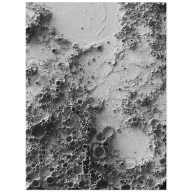
Digitally-rendered 3D elevation based on data from NASA’s Lunar Reconnaissance Orbiter. The center point of this print is at the location of the Ap...
View full details
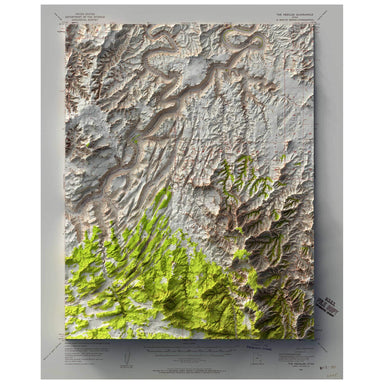
1953 United States Geological Survey map of The Needles, Utah combined with a digitally-rendered 3-dimensional elevation. 2D print Lustre Prints: ...
View full details
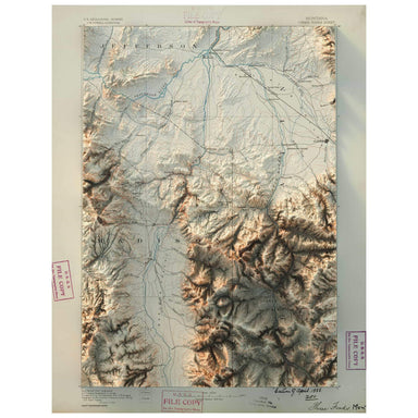
1888 United States Geological Survey map of Three Forks, Montana combined with a digitally-rendered 3-dimensional elevation. 2D print Lustre Print...
View full details

1955 Central Intelligence Agency map of Tibet combined with a digitally-rendered 3-dimensional elevation. 2D print Lustre Prints: Archival photo i...
View full details
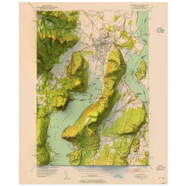
1952 United States Geological Survey topographic map of Sodus, New York combined with a digitally-rendered 3-dimensional elevation. 2D print Lustr...
View full details
1942 United States Geological Survey topographic map of Tillamook, Oregon combined with a digitally-rendered 3-dimensional elevation. 2D print Lus...
View full details
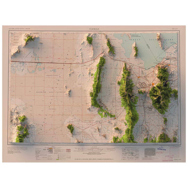
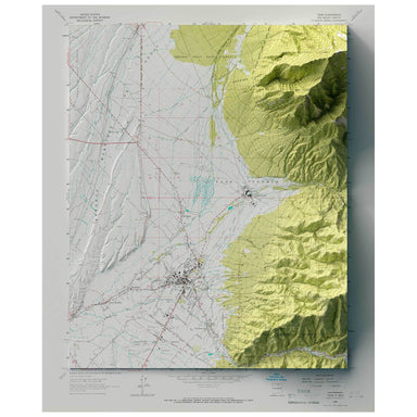
1958 Army Map Service map of Tooele, Utah combined with a digitally-rendered 3-dimensional elevation. 2D print Lustre Prints: Archival photo inkje...
View full details
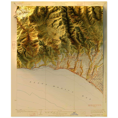
1928 United States Geological Survey topographic map of Topanga, California combined with a digitally-rendered 3-dimensional elevation. 2D print L...
View full details
1948 United States Geological Survey map of Trafalgar, Indiana combined with a digitally-rendered 3-dimensional elevation. 2D print Lustre Prints:...
View full details
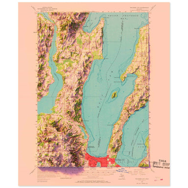
1957 United States Geological Survey topographic map of Traverse City, Michigan combined with a digitally-rendered 3-dimensional elevation. 2D pri...
View full details

A contemporary portrait of Alabama, drawn from tree coverage data and rendered with a minimalist approach. Each poster balances high-resolution car...
View full details

A contemporary portrait of Arkansas, drawn from tree coverage data and rendered with a minimalist approach. Each poster balances high-resolution ca...
View full details

A contemporary portrait of California, drawn from tree coverage data and rendered with a minimalist approach. Each poster balances high-resolution ...
View full details

A contemporary portrait of Colorado, drawn from tree coverage data and rendered with a minimalist approach. Each poster balances high-resolution ca...
View full details

A contemporary portrait of Connecticut, drawn from tree coverage data and rendered with a minimalist approach. Each poster balances high-resolution...
View full details