

California Geology
from $55.00
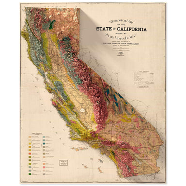
1916 State Mining Bureau of California geologic map of California combined with a digitally-rendered 3-dimensional elevation. 2D print Lustre Prin...
View full details
1916 State Mining Bureau of California geologic map of California combined with a digitally-rendered 3-dimensional elevation. 2D print Lustre Prin...
View full details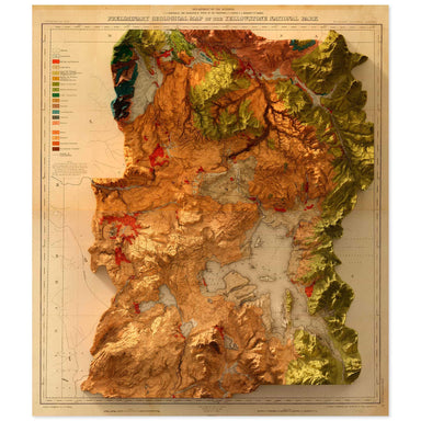
1878 United States Geological Survey geological map of Yellowstone National Park combined with a digitally-rendered 3-dimensional elevation. 2D pr...
View full details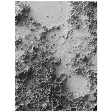
Digitally-rendered 3D elevation based on data from NASA’s Lunar Reconnaissance Orbiter. The center point of this print is at the location of the Ap...
View full details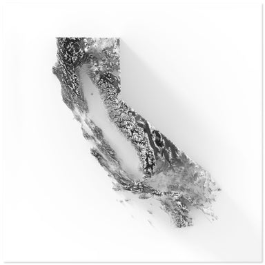
Digitally-rendered 3-dimensional elevation of California. 2D print Lustre Prints: Archival photo inkjet print on lustre (slight sheen) paper. Matt...
View full details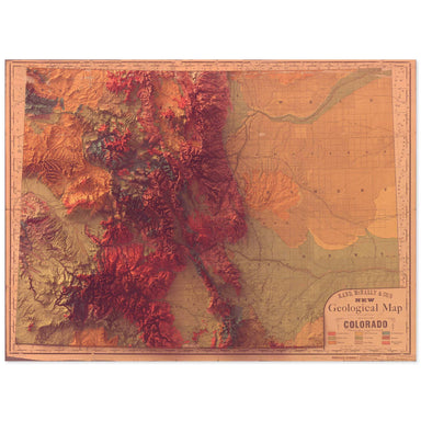
1880 Rand, McNally & Co. map of the geology of Colorado combined with a digitally-rendered 3-dimensional elevation. 2D print Lustre Prints: Ar...
View full details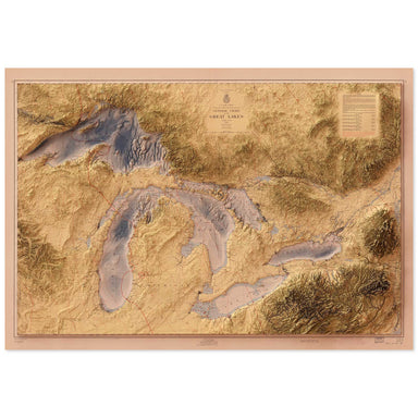
1955 United States Army Corps of Engineers map of the Great Lakes combined with a digitally-rendered 3-dimensional elevation. 2D print Lustre Prin...
View full details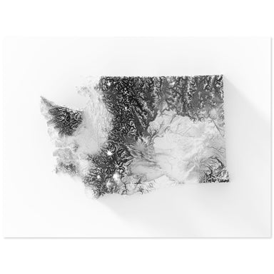
Digitally-rendered 3-dimensional elevation of Washington. 2D print Lustre Prints: Archival photo inkjet print on lustre (slight sheen) paper. Matt...
View full details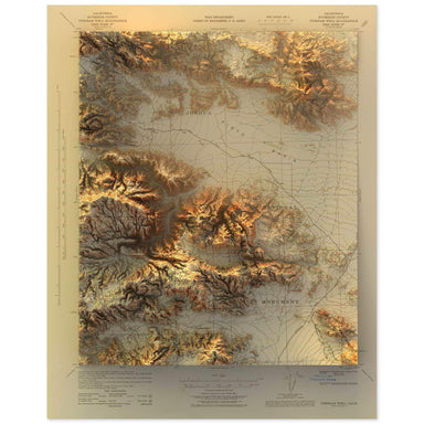
1943 United States Geological Survey topographic map of the Joshua Tree National Park region combined with a digitally-rendered 3-dimensional eleva...
View full details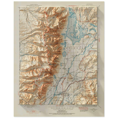
1899 United States Geological Survey topographic map of the Grand Teton National Park region combined with a digitally-rendered 3-dimensional eleva...
View full details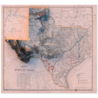
1887 “Map of the State of Texas” from the New York and Texas Land Company, Limited combined with a digitally-rendered 3-dimensional elevation. 2D ...
View full details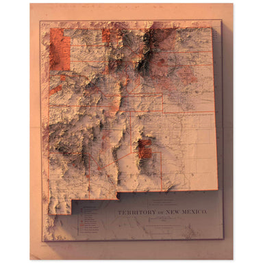
1882 Department of the Interior, General Land Office map of the New Mexico Territory combined with a digitally-rendered 3-dimensional elevation. 2...
View full details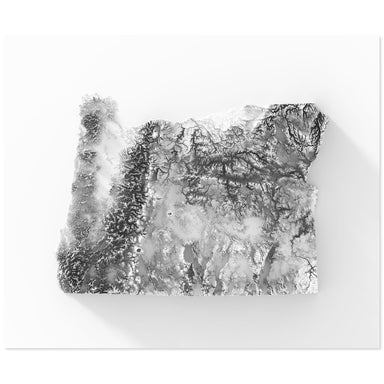
Digitally-rendered 3-dimensional elevation of Oregon. 2D print Lustre Prints: Archival photo inkjet print on lustre (slight sheen) paper. Matte Gi...
View full details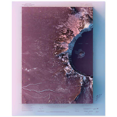
1975 United State Geological Survey topographic map of Crater Lake, Oregon combined with a digitally-rendered 3-dimensional elevation. 2D print Lu...
View full details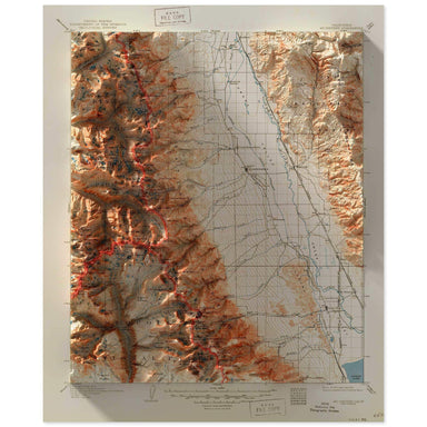
2D print Lustre Prints: Archival photo inkjet print on lustre (slight sheen) paper. Matte Giclée Prints: Archival pigment-based artist's print on ...
View full details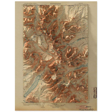
1904 United States Geological Survey topographic map of the Glacier National Park region combined with a digitally-rendered 3-dimensional elevation...
View full details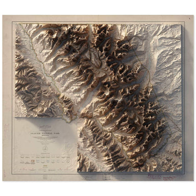
1915 United States Department of the Interior Administrative Map of Glacier National Park Montana combined with a digitally-rendered 3-dimensional ...
View full details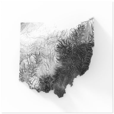
Digitally-rendered 3-dimensional elevation of Ohio. 2D print Lustre Prints: Archival photo inkjet print on lustre (slight sheen) paper. Matte Gicl...
View full details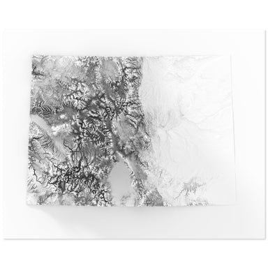
Digitally-rendered 3-dimensional elevation of Colorado. 2D print Lustre Prints: Archival photo inkjet print on lustre (slight sheen) paper. Matte ...
View full details
1980 United States Geological Survey topographic map of Zion National Park's Temple of Sinawava, including the famous Narrows hike, combined with a...
View full details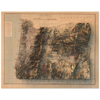
1879 Department of the Interior, General Land Office map of Oregon combined with a digitally-rendered 3-dimensional elevation. 2D print Lustre Pri...
View full details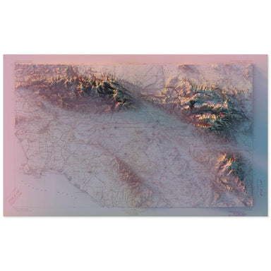
1901 United States Geological Survey topographic map of Southern California combined with a digitally-rendered 3-dimensional elevation. 2D print L...
View full details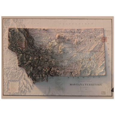
1879 Department of the Interior, General Land Office map of Montana combined with a digitally-rendered 3-dimensional elevation. 2D print Lustre Pr...
View full details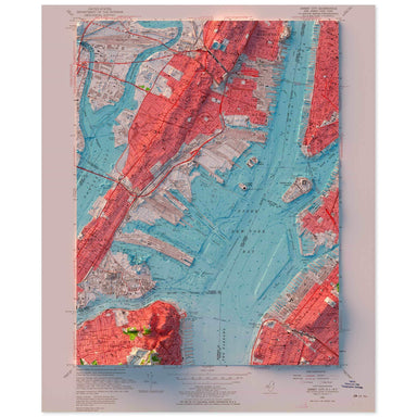
1955 United States Geological Survey topographic map of the New York Harbor combined with a digitally-rendered 3-dimensional bathymetry and elevati...
View full details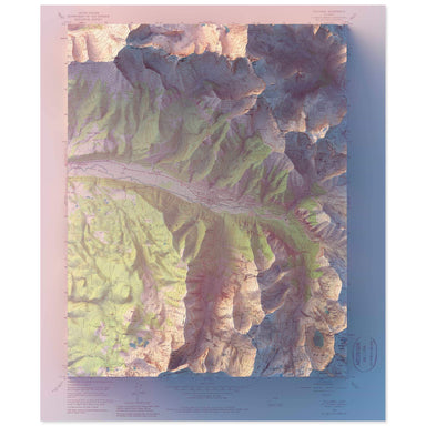
1955 United States Geological Survey geological map of Telluride, Colorado combined with a digitally-rendered 3-dimensional elevation. 2D print Lu...
View full details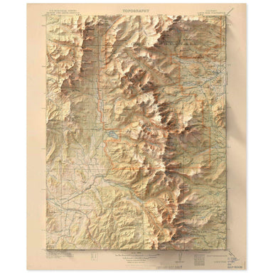
1915 United States Geological Survey topographic map of the Rocky Mountain National Park region combined with a digitally-rendered 3-dimensional el...
View full details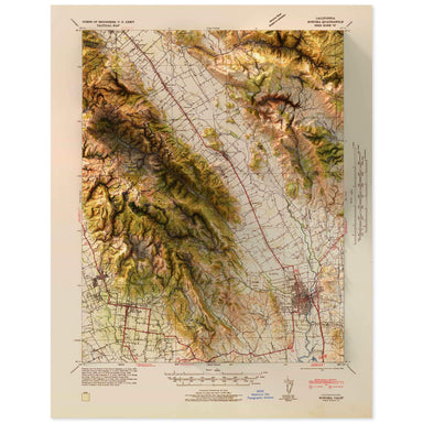
1942 United States Geological Survey map of Napa Valley, California combined with a digitally-rendered 3-dimensional elevation. 2D print Lustre Pr...
View full details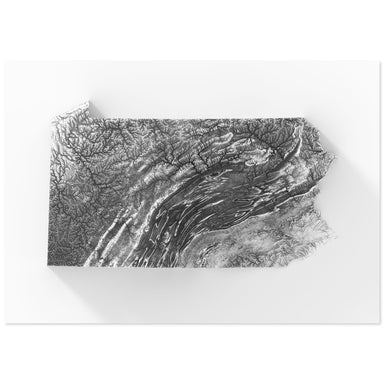
Digitally-rendered 3-dimensional elevation of Pennsylvania. 2D print Lustre Prints: Archival photo inkjet print on lustre (slight sheen) paper. Ma...
View full details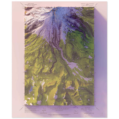
1962 United States Geological Survey topographic map of Mt. Hood, Oregon combined with a digitally-rendered 3-dimensional elevation. 2D print Lust...
View full details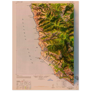
1947 United States Geological Survey topographic map of Point Sur, California combined with a digitally-rendered 3-dimensional elevation. 2D print...
View full details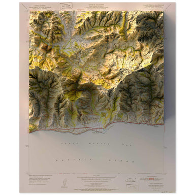
1951 United States Geological Survey topographic map of Malibu, California combined with a digitally-rendered 3-dimensional elevation. 2D print Lu...
View full details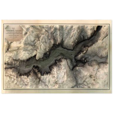
1865 map of the Yosemite Valley, California combined with a digitally-rendered 3-dimensional elevation. 2D print Lustre Prints: Archival photo ink...
View full details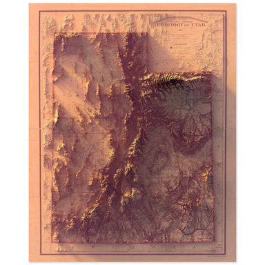
1893 Department of the Interior map of Utah combined with a digitally-rendered 3-dimensional elevation. 2D print Lustre Prints: Archival photo ink...
View full details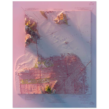
1947 United States Geological Survey topographic map of San Francisco combined with a digitally-rendered 3-dimensional elevation. 2D print Lustre ...
View full details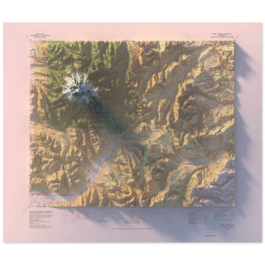
1978 United States Geological Survey geological map of Mt. Rainier, Washington combined with a digitally-rendered 3-dimensional elevation. 2D prin...
View full details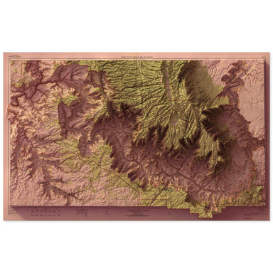
1962 United States Geological Survey topographic map of Grand Canyon National Park combined with a digitally-rendered 3-dimensional elevation. 2D ...
View full details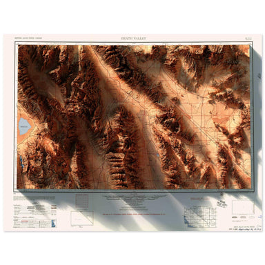
1956 Army Map Services topographic map of Death Valley, California combined with a digitally-rendered 3-dimensional elevation. 2D print Lustre Pri...
View full details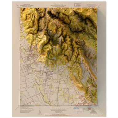
1951 United States Department of the Interior Administrative Map of Sonoma, California combined with a digitally-rendered 3-dimensional elevation. ...
View full details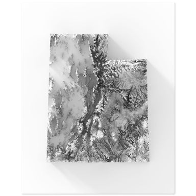
Digitally-rendered 3-dimensional elevation of Utah. 2D print Lustre Prints: Archival photo inkjet print on lustre (slight sheen) paper. Matte Gicl...
View full details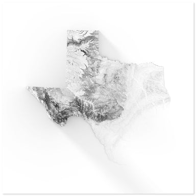
Digitally-rendered 3-dimensional elevation of Texas. 2D print Lustre Prints: Archival photo inkjet print on lustre (slight sheen) paper. Matte Gic...
View full details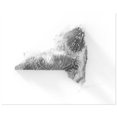
Digitally-rendered 3-dimensional elevation of New York. 2D print Lustre Prints: Archival photo inkjet print on lustre (slight sheen) paper. Matte ...
View full details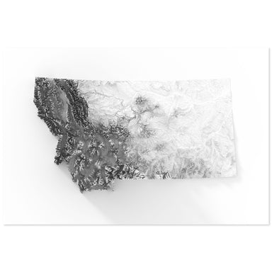
Digitally-rendered 3-dimensional elevation of Montana. 2D print Lustre Prints: Archival photo inkjet print on lustre (slight sheen) paper. Matte G...
View full details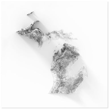
Digitally-rendered 3-dimensional elevation of Michigan. 2D print Lustre Prints: Archival photo inkjet print on lustre (slight sheen) paper. Matte ...
View full details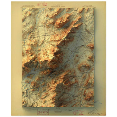
1896 United States Geological Survey map of Lake Placid, New York combined with a digitally-rendered 3-dimensional elevation. 2D print Lustre Prin...
View full details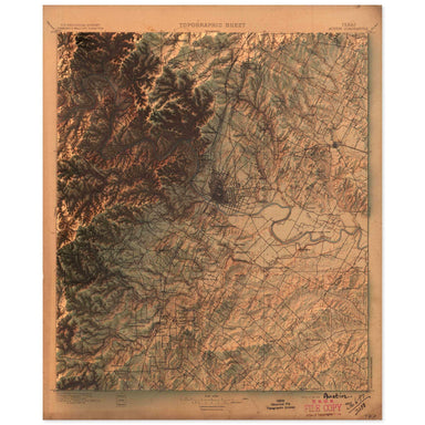
1897 United States Geological Survey topographic map of Austin, Texas combined with a digitally-rendered 3-dimensional elevation. 2D print Lustre ...
View full details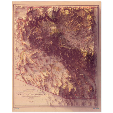
1899 Department of the Interior, General Land Office map of the Arizona Territory combined with a digitally-rendered 3-dimensional elevation. 2D p...
View full details

1904 United States Geological Survey topographic map of the Acadia National Park region combined with a digitally-rendered 3-dimensional elevation....
View full details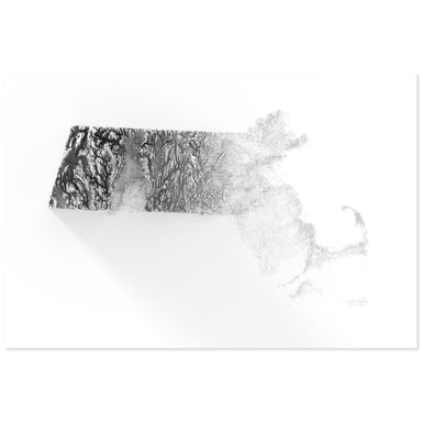
Digitally-rendered 3-dimensional elevation of Massachusetts. 2D print Lustre Prints: Archival photo inkjet print on lustre (slight sheen) paper. M...
View full details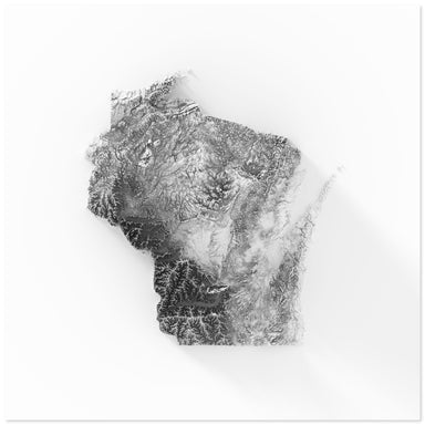
Digitally-rendered 3-dimensional elevation of Wisconsin. 2D print Lustre Prints: Archival photo inkjet print on lustre (slight sheen) paper. Matte...
View full details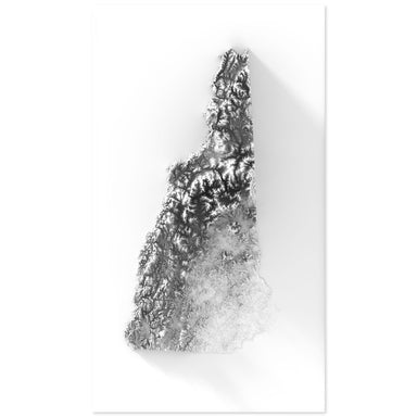
Digitally-rendered 3-dimensional elevation of New Hampshire. 2D print Lustre Prints: Archival photo inkjet print on lustre (slight sheen) paper. M...
View full details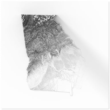
Digitally-rendered 3-dimensional elevation of Georgia. 2D print Lustre Prints: Archival photo inkjet print on lustre (slight sheen) paper. Matte G...
View full details