


Acadia
from $55.00
1904 United States Geological Survey topographic map of the Acadia National Park region combined with a digitally-rendered 3-dimensional elevation....
View full details
1904 United States Geological Survey topographic map of the Acadia National Park region combined with a digitally-rendered 3-dimensional elevation....
View full details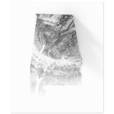
Digitally-rendered 3-dimensional elevation of Alabama. 2D print Lustre Prints: Archival photo inkjet print on lustre (slight sheen) paper. Matte G...
View full details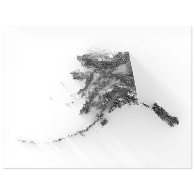
Digitally-rendered 3-dimensional elevation of Alaska. 2D print Lustre Prints: Archival photo inkjet print on lustre (slight sheen) paper. Matte Gi...
View full details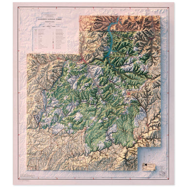
1973 U.S. Department of Agriculture, Forest Service map of Allegheny National Forest combined with a digitally-rendered 3-dimensional elevation. 2...
View full details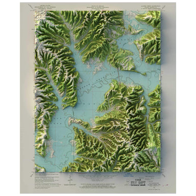
1966 United States Geological Survey map of Allens Creek, Indiana combined with a digitally-rendered 3-dimensional elevation. 2D print Lustre Prin...
View full details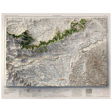
1958 United States Geological Survey map of Alliance, Nebraska combined with a digitally-rendered 3-dimensional elevation. 2D print Lustre Prints:...
View full details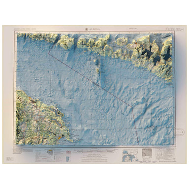
1957 Army Map Service map of Alpena, Michigan combined with a digitally-rendered 3-dimensional elevation. 2D print Lustre Prints: Archival photo i...
View full details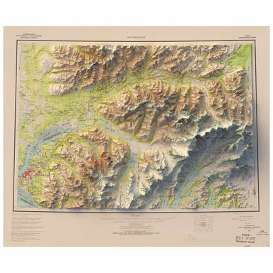
1962 United States Geological Survey map of Anchorage, Alaska combined with a digitally-rendered 3-dimensional elevation. 2D print Lustre Prints: ...
View full details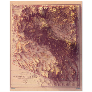
1899 Department of the Interior, General Land Office map of the Arizona Territory combined with a digitally-rendered 3-dimensional elevation. 2D p...
View full details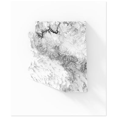
Digitally-rendered 3-dimensional elevation of Arizona. 2D print Lustre Prints: Archival photo inkjet print on lustre (slight sheen) paper. Matte G...
View full details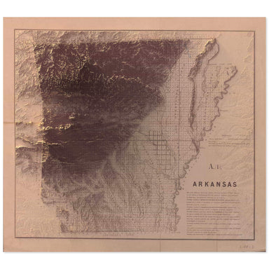
1851 map of Arkansas combined with a digitally-rendered 3-dimensional elevation. 2D print Lustre Prints: Archival photo inkjet print on lustre (sl...
View full details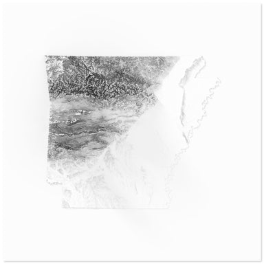
Digitally-rendered 3-dimensional elevation of Arkansas. 2D print Lustre Prints: Archival photo inkjet print on lustre (slight sheen) paper. Matte ...
View full details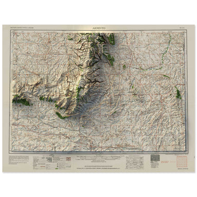
1958 Army Map Service map of Arminto, Wyoming combined with a digitally-rendered 3-dimensional elevation. 2D print Lustre Prints: Archival photo i...
View full details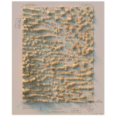
1949 United States Geological Survey topographic map of Ashby, Nebraska combined with a digitally-rendered 3-dimensional elevation. 2D print Lustr...
View full details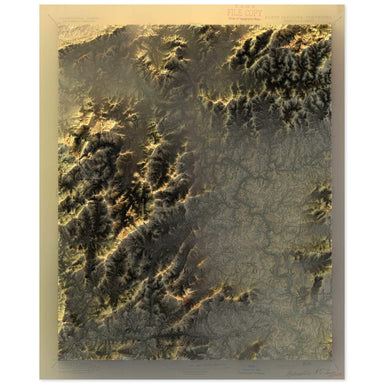
1894 United States Geological Survey topographic map of the Asheville, North Carolina region combined with a digitally-rendered 3-dimensional eleva...
View full details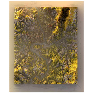
1943 United States Geological Survey topographic map of Asheville, North Carolina combined with a digitally-rendered 3-dimensional elevation. 2D p...
View full details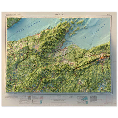
1958 Army Map Service map of Ashland, Wisconsin combined with a digitally-rendered 3-dimensional elevation. 2D print Lustre Prints: Archival photo...
View full details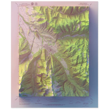
1960 United States Geological Survey geological map of Aspen, Colorado combined with a digitally-rendered 3-dimensional elevation. 2D print Lustre...
View full details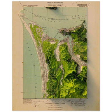
1919 United States Geological Survey topographic map of Astoria, Oregon combined with a digitally-rendered 3-dimensional elevation. 2D print Lustr...
View full details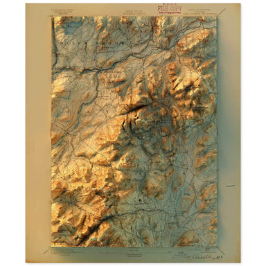
1895 United States Geological Survey topographic map of Ausable, New York combined with a digitally-rendered 3-dimensional elevation. 2D print Lus...
View full details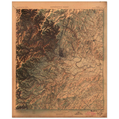
1897 United States Geological Survey topographic map of Austin, Texas combined with a digitally-rendered 3-dimensional elevation. 2D print Lustre ...
View full details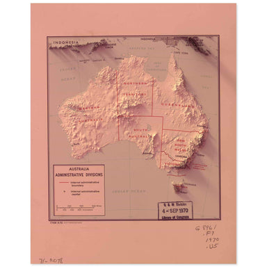
1970 Central Intelligence Agency map of Australia combined with a digitally-rendered 3-dimensional elevation. 2D print Lustre Prints: Archival pho...
View full details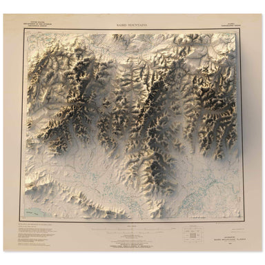
1956 United States Geological Survey map of Baird Mountains, Alaska combined with a digitally-rendered 3-dimensional elevation. 2D print Lustre Pr...
View full details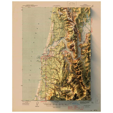
1944 United States Geological Survey topographic map of Bandon, Oregon combined with a digitally-rendered 3-dimensional elevation. 2D print Lustre...
View full details