

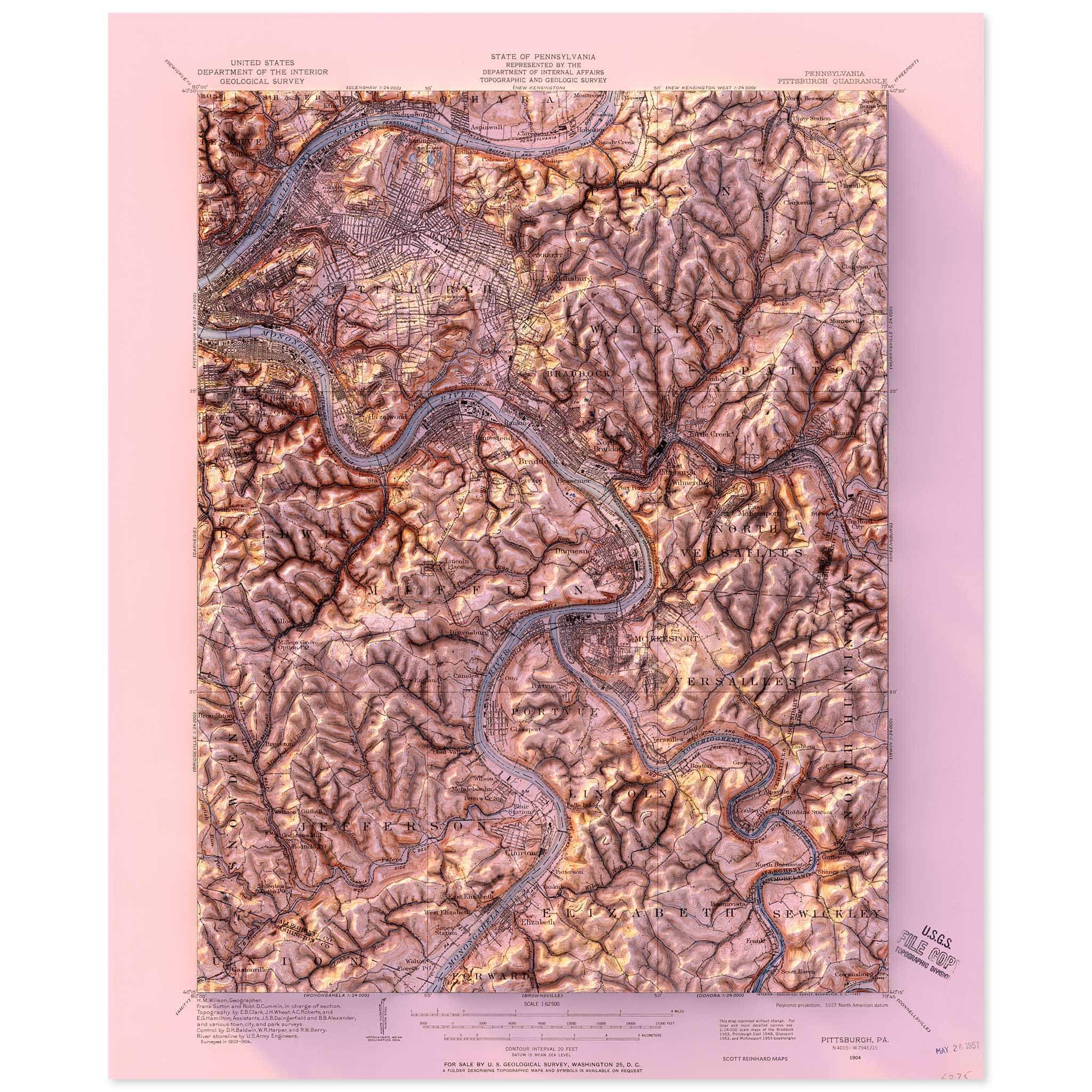
Pittsburgh, Pennsylvania
1904 United States Geological Survey topographic map of Pittsburgh, Pennsylvania combined with a digitally-rendered 3-dimensional elevation.
2D print
Lustre Prints: Archival photo inkjet print on lustre (slight sheen) paper.
Matte Giclée Prints: Archival pigment-based artist's print on a smooth neutral white matte paper.
Framed prints ship matless in custom white gallery frame with acrylic.
Note: Unframed prints ship in up to 7 business days from date of purchase. Framed prints ship in 4-6 weeks. Please read the FAQ here.
Areas of interest include the Monongahela River, Mount Washington, Shadyside, North Shore, Allentown, South Oakland, Squirrel Hill North, South Shore, East Liberty, Hill District, Brookline, Homewood North, Bloomfield, Polish Hill, Northview Heights, Stanton Heights, Beechview, Duquesne Heights, Allegheny Center, South Side Slopes, Betzhoover, Swisshelm Park, Sharden, Crafton Heights.