


Hypercolor North America
from $55.00
Digitally-rendered 3D elevation based on United States Geological Survey elevation data with custom color gradient applied. 2D print Lustre Prints...
View full details
Digitally-rendered 3D elevation based on United States Geological Survey elevation data with custom color gradient applied. 2D print Lustre Prints...
View full details
A look at what the lower 48 states of the United States would look like if it were flipped inside out. 2D print Lustre Prints: Archival photo inkj...
View full details
1976 Central Intelligence Agency map of Ethiopia combined with a digitally-rendered 3-dimensional elevation. 2D print Lustre Prints: Archival phot...
View full details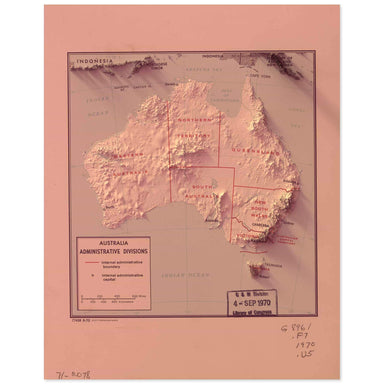
1970 Central Intelligence Agency map of Australia combined with a digitally-rendered 3-dimensional elevation. 2D print Lustre Prints: Archival pho...
View full details
1955 Central Intelligence Agency map of Tibet combined with a digitally-rendered 3-dimensional elevation. 2D print Lustre Prints: Archival photo i...
View full details